
View from above and north (Scale 1m).
A probable single stone row measuring 13.8m long, including 4 large-sized stones situated on a terrace on an east facing slope. One stone is upright and maybe a natural boulder which was partially exposed in antiquity. The row is orientated NNE to SSW. Another probable row exists in the vicinity.
Location
| Wales | Powys | Mid Wales | SO 08465 56835 |
| Lat 52.202085 Long -3.340769 | |||
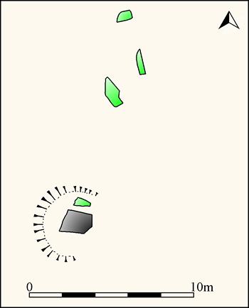
Map showing the location of Court 1 stone row
Plan of Court 1 stone row and hollow cut around the southern stone (Source: survey at 1:200 by Sandy Gerrard).
Characteristics
| Type: Single | Length: 13.8m |
| No. of stones: 4 | Size of stones: Only large |
| Orientation: 18° | Altitude: 298m |
| Upper end: – | Lower end: – |
| Straight (Yes or No) : Not known | Sea View: No |
| Context: Stone row | |
| Notes: The southern stone is probably a natural boulder which has been deliberately incorporated into the stone row. | |
Other Information
| Public Access: Yes |
| Land Status: |
| Scheduled Ancient Monument: RD225 |
Interpretation
Category: Probable. The ruinous condition of this site means that it is not possible to be certain that this group of stones represent the remains of a prehistoric stone row. It could represent a natural outcrop or the much truncated remains of another form of monument. On balance however, on the basis of the existing evidence a stone row interpretation seems probable.
Typology
This stone row is of Type S2. Information on this form of stone row and other rows of this type is available here.
Photographs

The large stone forming the southern end of the row is pock-marked on its western face. The position of the Court 2 stone row is highlighted. Originally Court 2 would have been visible on the skyline from Court 1. View from west (Scale 1m).

View from south west (Scale 1m).

View from above and south west (Scale 1m). The large stone in the foreground sits within a substantial hollow. It is unlikely that this has been formed by animal poaching and is much more likely to have been the result of deliberate exposure of the lower parts of this rock when the row was being built. The same happened at Carreg Llwyd where the southern stone had also been exposed. The most plausible explanation is that a natural rock was incorporated into these rows and enhanced by the removal of soil from around their base.

View from above and south. The ranging rod denotes the northern end of the row. The hollow cut around the near stone is clearly visible (Scale 1m).
Individual Stones

Plan showing the position of the numbered stones.

Stone 1 measures 1.8m long by 1.4m wide and stands up to 2.07m high. A fragment of rock split from the stone stands to the left of the ranging rod (Scale 1m). Stone 1 is pock-marked on its western face and this has been interpreted as cup-marks by some authorities and as a natural by others. On balance a natural origin seems most likely because the hollows are sharp-sided and relatively small. View from west.

Stone 2 measures 1.97m long by 0.9m wide and stands up to 0.28m above the ground surface. View from north with stone 1 in the background (Scale 1m).

Stone 3 measures 1.6m long by 0.4m wide and stands up to 0.14m above the ground surface. View from north with stones 1 and 2 in the background (Scale 1m).

Stone 4 measures 1m long by 0.65m wide and stands up to 0.16m above the ground surface. View from north with stones 1-3 in the background (Scale 1m).
Access Information
Limited car parking is available at SO 08425 56739. The row is visible nearby.
Online Resources
Megalithic Portal Coflein Archwilio
Timeline
VISITED:- 22nd August 2018
FIRST PUBLISHED:- 12th February 2016
LAST UPDATED:- 15th March 2019
