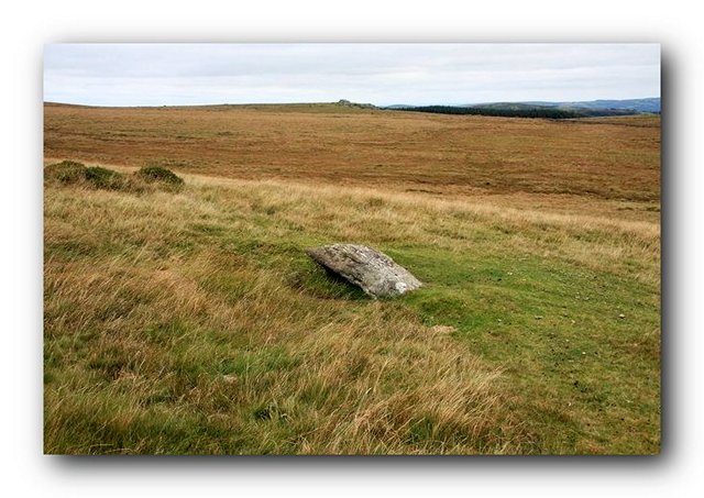
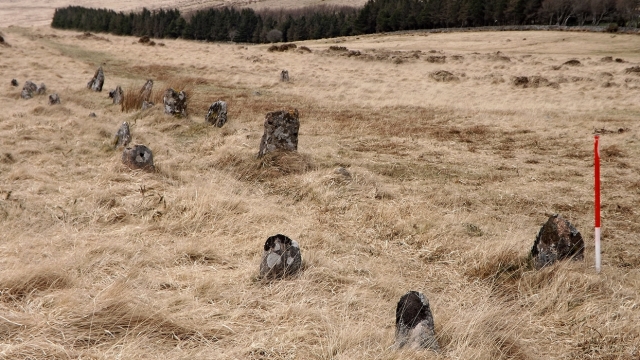
The Three Boys. Blocking stone and two smaller stones probably representing the remains of a double row.
© Copyright Guy Wareham and licensed for reuse under this Creative Commons Licence.
A much-mutilated double stone row measuring 170m long, now including only two small and two large-sized stones forming part of a cluster of six stone rows, a stone circle and three cairns. This row is situated on a south facing slope, is orientated north to south and stands close to a later prehistoric settlement and coaxial field system.
Location
| England Devon Dartmoor SX 66028 85678 Lat 50.655325 Long -3.8966268 |
Map showing the location of Shoveldown 6 stone row.
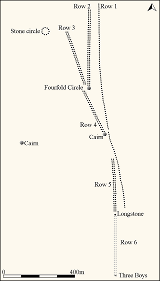
Simplified plan of the Shoveldown stone alignments (Source: Butler, J., 1992, 179).
Characteristics
| Type: Double | Length: 170m |
| No. of stones: 4 | Size of stones: Small and large only |
| Orientation: 180° | Altitude: 421m |
| Upper end: Pillar? | Lower end: Blocking stone |
| Straight (Yes or No) : ? | Sea View: Yes |
| Context: Stone alignments, stone circle, prehistoric settlements, field system and cairn. | |
| Notes: Severely damaged. Probably originally included smaller stones as well. | |
Other Information
| Public Access: Yes |
| Land Status: National Park |
| Scheduled Ancient Monument: Yes |
Identification
Category: Probable. This site has been severely damaged and therefore a definitive interpretation is not possible. Despite this it is likely that it represents the remains of a stone row.
Typology
This stone row is of Type D9. Information on this form of stone row and other rows of this type is available here.
Photographs

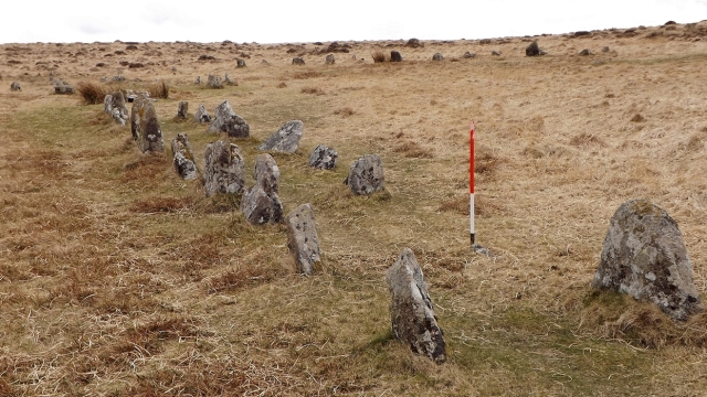
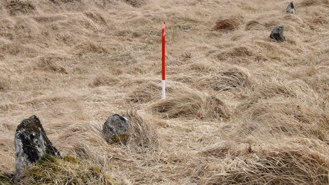
Blocking stone and two smaller stones that probably formed the southern end of the row. View from north east (Scale 1m).

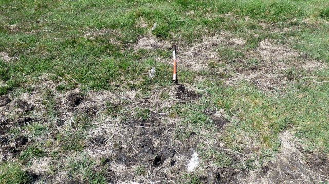
Fallen blocking stone. The small stone below the slab probably forms part of the row, although it may have been a trig stone for the now fallen blocking stone (Scale 1m).
Access Information
Car parking is available at SX 66205 86548. From here head SSW across open moorland to the stone rows.
Nearest Neighbour

Shoveldown 5 (2m)
Nearby Rows
Shoveldown 1 (34m)
Shoveldown 2 (355m)
Shoveldown 3 (360m)
Shoveldown 4 (226m)
Online Resources
Megalithic Portal Modern Antiquarian PastScape Historic Environment Record
Prehistoric Monuments of Dartmoor Prehistoric Dartmoor Walks
Other References
Burl, A., 1993, From Carnac to Callanish – The prehistoric rows and avenues of Britain, Ireland and Brittany, Yale University Press, New York and London, pg. 215.
Butler, J., 1991, Dartmoor Atlas of Antiquities – Vol. 2 – The North, Devon Books Exeter, pgs.182-184.
Timeline
VISITED:- 5th July 2016
FIRST PUBLISHED:- 24th January 2016
LAST UPDATED:- 10th June 2020
