
The stone alignment in the foreground is incorporated into the later prehistoric enclosure wall.
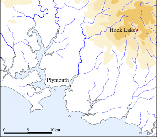
The double stone alignment at Hook Lake within the Erme Valley is surrounded by hills and it is therefore remarkable that it includes a view towards a sea triangle formed by Stall Moor on the right and Stalldown Barrow on the left. The stone alignment itself includes a double row of stones leading downslope for 227m from a kerbed cairn at SX 64110 65330. The row is partly incorporated into a later prehistoric round house and enclosure. A sea triangle is visible from the top of the row and diminishes in size as one walks down along the row and finally disappears approximately 100m from the lower end. This characteristic of alignments including a length with very restricted views to the sea and another length with no sea views is repeated at a significant number of alignments and the frequency strongly suggests an element of deliberation. The hypothesis being presented is that the alignments were deliberately located and positioned in places where specific landmarks such as sea triangles would change in form as you walk along the carefully defined routeway. Utilising the natural topography the alignment builders were able to replicate this time and time again at different places on the moor.
Views from the alignment
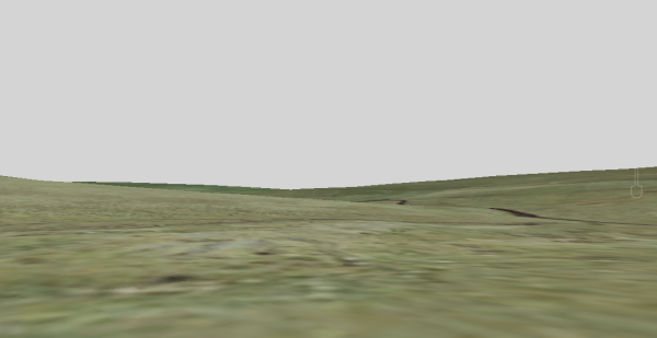
A series of images from Google Earth are presented below. The first one represents the view from the top of the row, the second from the point mid-way along the length of the row and the third from the lower end.

From the top of the alignment the sea triangle is a prominent and eye-catching natural phenomenon. Under specific lighting conditions and at a particular time of day it would have manifested itself as triangle of bright light.

Half way down the alignment the sea triangle is considerably reduced in size and 100m from the end the sea disappears from view.
The lower length of the row has no views to the sea. This Google Earth image is from the lower end of the row illustrates that the sea is no longer visible.
Profile Analysis
An examination of cross-sectional profiles from the row to the sea allows the arc of inter-visibility to be plotted onto a map. The juxtaposition of the nearby hills block other views to the sea and thereby create the small clearly defined triangle of visible sea.

This map shows the maximum arc of visibility from the Hook Lake double stone alignment. This diminishes rapidly as one moves downward along the row until just over half way the sea disappears behind the lower slopes of Stall Moor. The alignment is situated within a valley with much higher ground on three sides and indeed the restricted partial view to the sea is all the more remarkable because of prominent hills on the remaining side.

