
Three stones forming part of the alignment. Most of the stones are hidden by gorse.

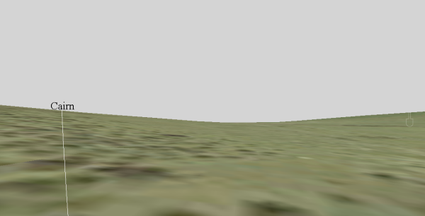
The double stone alignment situated on the south west facing slope of Brent Fore Hill forms part of a discrete cluster of prehistoric funerary monuments including a long cairn and large numbers of round cairns. The stone alignment itself includes a double row of stones leading downslope for 120m from a kerbed cairn at SX 66843 61367. Walking upslope along this alignment a remarkable “reveal” is experienced. The view from the bottom of the alignment is very restricted but as one walks uphill a view eastwards towards South Devon and the sea emerges as if from the ground as the cairn at the top is approached. From the cairn two sea triangles are visible of which the northern one is “closed” by the coast of Dorset in the background. When first revealed the southern sea triangle is split into two by a small hill in the distance but at the top of the alignment the two triangles merge.
The view from the lower end of the alignment is very restricted. The line denotes the approximate position of the alignment.

63m from the top of the alignment there is still no view of the sea.

45m from the top of the alignment a pair of sea triangles appear from behind the brow of the hill. A small hill in the far distance separates the triangles from each other.

As one proceeds up the hill the triangles grow in size .
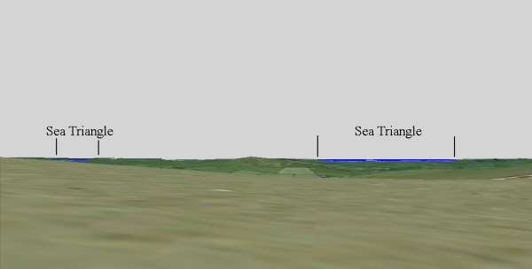
Just as one reaches the cairn at the top of the alignment the pair of sea triangles on the right merge into one and a second triangle appears on the left. The second triangle is of the “closed variety”. The top of a closed sea triangle is formed by land rather than the sky and in this case the Jurassic Coast provides the closure.
The transition from restricted views to extensive ones incorporating specific types of sea view is now being recognised as common place amongst the Dartmoor alignments. Obviously this feature is not shared by all alignments and there are many with no views to the sea at all. Variation in form is a recognised characteristic of the alignments and it would therefore be surprising if all of them shared an identical topographic setting. This said, a case is certainly building to support the idea that many alignments were designed to channel people along a specific route where significant changes in the appearance of the landscape could be observed and perhaps celebrated. This is most obviously manifested with the sea triangles but other significant features in the landscape could have been signified in this way. The crucial aspect appears to be that the “waymarked route” was designed to provide at least one “reveal”.
Profile Analysis
An examination of cross-sectional profiles from the alignment to the sea allows the arcs of inter-visibility to be plotted onto a map. The juxtaposition of the hills in the middle distance block other views to the sea and thereby create the small clearly defined triangles of visible sea.

This map shows the maximum arcs of visibility from the cairn at the top of the Brent Fore Hill stone alignment. Arc A is visible only from the top of the alignment and is closed by the Jurassic Coast. Arc B is the first one to come into sight and evolves from a pair of conjoined triangles into a single much larger one when viewed from the top.

Cross-sectional profile along the centre of the arc of visibility “A”. This indicates that the nearest visible sea is around 32km from Brent Fore Hill with the coast of Dorset beyond.

Cross-sectional profile along the centre of the arc of visibility “B”. This indicates that the nearest visible sea is around 28km from Brent Fore Hill.
