
Looking west along the western end of the feature.
Location
| Scotland | Highland | Rest of Scotland | NH 62099 43262 |
| Lat 57.45870064 Long -4.30027666 | |||
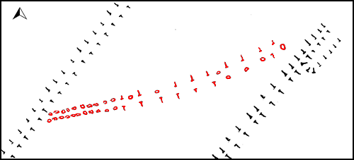
Sketch plan of the field boundary at Ladystone Farm.
Characteristics
| Type: Field wall | Length: 90m |
| No. of stones: More than 80 | Size of stones: Small and medium |
| Orientation: 77° | Altitude: 223m |
| Upper end: – | Lower end: – |
| Straight (Yes or No) : No | Sea View: Yes |
| Context: – | |
| Notes: | |
Other Information
| Public Access: Yes |
| Land Status: |
| Scheduled Ancient Monument: No |
Interpretation
Category: Not a row. This is a double faced wall leading from one field boundary to another. In places the stones are touching. It is perhaps significant that the eastern end of the feature coincides with the start of a ditch associated with the other field boundary. Along part of the length of the feature it is clearly formed by a rubble bank. This feature is a field boundary and probably of historic date.
Photographs

The stones are set very close together and clearly form part of a field boundary which may either never have been finished or has been robbed. View from east (Scale 1m).

Looking east along the field boundary (Scale 1m).

Looking west along the feature. The rubble bank leads away behind the ranging rod (Scale 1m).

Detail of the field wall. View from west (Scale 1m).

The rubble bank forming part of the feature stands to the left of the ranging rod. View from west (Scale 1m).

The southern side of the rubble bank is very obvious at this point. View from south (Scale 1m).

The easternmost stone stands opposite the point where a ditch associated with another bank starts. View from south.
Access Information
The feature is situated next to The Great Glen Way. Parking is available at NH 63879 44891. From here follow the road uphill to NH 63324 44654 and take the track on your right which joins the Great Glen Way at NH 62634 43756.
