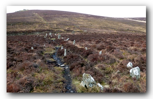
The northern part of the alignment. View from the south.
A triple stone row measuring at least 145.65m long, including 68 mainly medium-sized stones together with some small and large-sized stones situated on a north facing slope with landscape reveals. The row is orientated NNW to SSE and was partly restored in the 1890’s. The largest stone is at the SSE end and the NNW end may have been truncated by tinworking.
Location
| England Devon Dartmoor SX 69016 80718 Lat 50.611426 Long -3.85262 |
Map showing the location of Challacombe Down stone row.
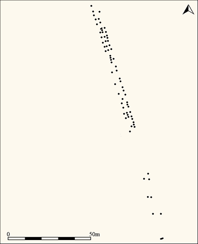
Simplified plan of the Challacombe triple stone alignment (Source, Butler, J., 1991).

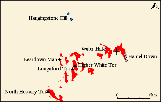
Map showing the position of Challacombe Down, other stone rows and sites.
Characteristics
| Type: Triple | Length: 145.6m |
| No. of stones: 68 | Size of stones: Small, medium and large |
| Orientation: 158° | Altitude: 436m |
| Upper end: Pillar | Lower end: – |
| Straight (Yes or No) : No | Sea View: No |
| Context: – | |
| Notes: The lower (northern) end of the alignment may have been truncated by historic tinworking. | |
Other Information
| Public Access: Yes |
| Land Status: National Park |
| Scheduled Ancient Monument: Yes |
Identification
Category: Plausible. No doubts have been expressed regarding the prehistoric interpretation of this row.
Typology
This stone row is of Type T12. Information on this form of stone row and other rows of this type is available here.
Photographs

Looking south along the row. Click on image to enlarge.
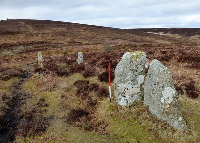
Stone set across the orientation of the row. View from the south (Scale 1m).
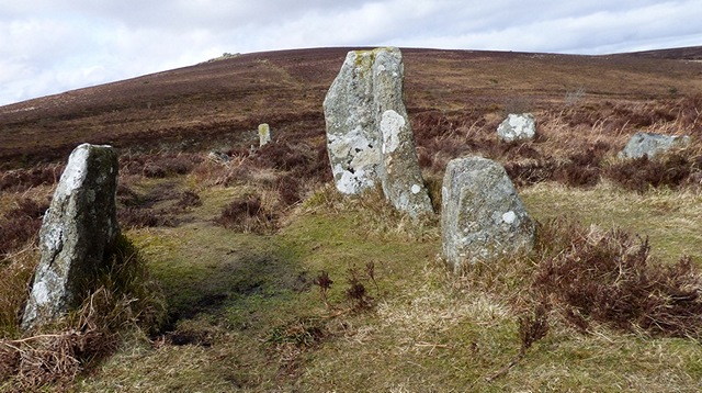
The large stone is set at right angles to the others within the row. It may not be a coincidence that this spot coincides with the point that the cairn on the summit of Hangingstone Hill disappears as you walk northward along the row. Alternatively it may have been re-erected at the wrong angle!
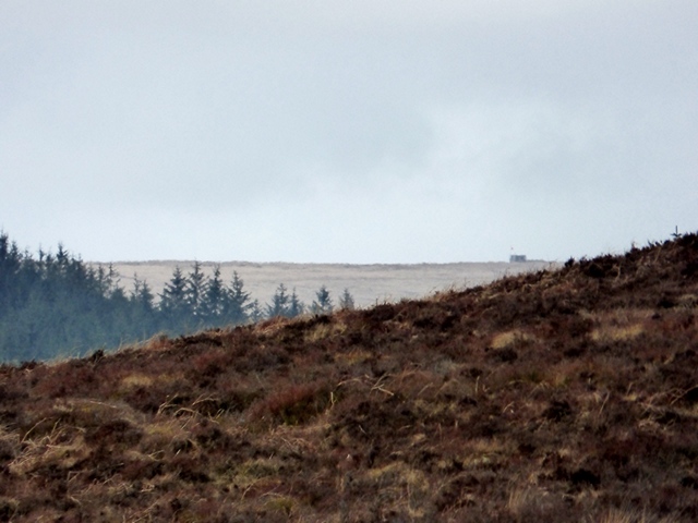
The cairn on Hangingstone Hill is at the very edge of visibility at the point where the large stone is set at right angles to the row.

Looking north along the row. The stones to the left of the row are thought to be a “modern” addition, although there is no evidence to support this conclusion.
A setting of stones adjacent to the western side of the row is considered to have erected by tinners who had removed the lower end of the row and moved the displaced stones to a new location for superstitious reasons. There is no evidence to support this explanation which whilst appealing is not entirely convincing. Perhaps the reason for not accepting that it is a contemporary setting is that arrangements such as these have not yet been identified elsewhere on Dartmoor. Whilst uniqueness is something that is often celebrated and indeed emphasised within the archaeological world , on occasions it is simply dismissed. Perhaps further work in the future will resolve this conundrum.

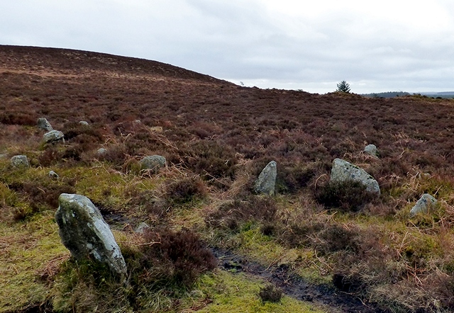
The northern length of this triple stone alignment survives best and protrudes through the dense heather. The southern length is mainly composed of smaller stones many of which hidden by the heather. View from south. Click on image to enlarge.
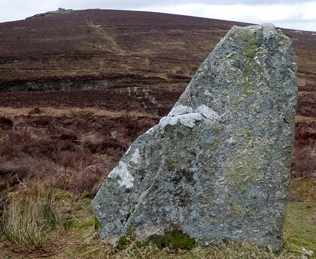
The blocking stone at the upper southern end of the row consists of a large slab of granite. View from the south.
Landmark Reveals
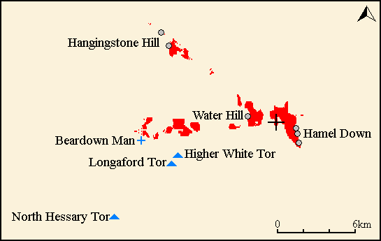
The Challacombe triple stone row does not possess an extensive or obvious reveal found at many sites. Despite this the position of the row ensures that the views from the top and bottom are very different and constantly change as you move along the row. At the bottom the views are mainly towards the west with the Beardown Man standing stone together with Higher White Tor and Longaford Tor at the limit of visibility. Nearby cairns on Hamel Down and Water Hill are also prominently positioned.
Viewshed (red) from the northern end (bottom) of the row (Source: Heywhatsthat.com)
As one walks up and southward along the row the views become increasingly focussed towards the north west. At the point where a slab is set at right angles the cairn on Hangingstone Hill appears. As you progress up the hill the views to the west are increasingly restricted. Throughout the length of the row the cairns on Hamel Down and Water Hill remain on the sky line.
 Viewshed (red) from the southern end (top) of the row (Source: Heywhatsthat.com)
Access Information
Car parking is available at SX 69539 81377. From here walk south west across the open moorland keeping the fields of Headland Warren Farm to your left. The row is visible from the car parking area.
Online Resources
Megalithic Portal Modern Antiquarian PastScape Historic Environment Record
Prehistoric Monuments of Dartmoor Prehistoric Dartmoor Walks
Other References
Burl, A., 1993, From Carnac to Callanish – The prehistoric rows and avenues of Britain, Ireland and Brittany, Yale University Press, New York and London, pg. 214.
Butler, J., 1991, Dartmoor Atlas of Antiquities – Vol. 2 – The North, Devon Books Exeter, pgs. 19-20.
Timeline
VISITED:- 3rd March 2016
FIRST PUBLISHED:- 16th January 2016
LAST UPDATED:- 22nd November 2020
