
Alignment passing a cairn. View from east.
A single stone row measuring 717m long, including at least 173 mainly small stones situated on a south facing slope with sea and landscape visual links and reveals. The row leads from a small cairn, terminates at the largest stone, is orientated north east to south west and stands between two cairn cemeteries. The visual links with Hartland Point and Exmoor are noteworthy. Excavation failed to provide a date but confirmed a lack of historic activity.
Location
| Wales Carmarthenshire Brecon Beacons SN 68936 10326 Lat 51.7761462 Long -3.9011152 |
Map showing the location of Bancbryn stone row.
Bancbryn stone alignment (Base mapping: Google My Maps).

Plan of the Bancbryn stone alignment. Cairn at top shown red. From survey by Sandy Gerrard at 1:500.

Plan of the upper part of the row showing stones, cairn and adjacent coal workings. From original survey at 1:500 by Sandy Gerrard.

Map showing position of broadly contemporary archaeology within the vicinity of Bancbryn stone row.
Characteristics
| Type: Single | Length: 717m |
| No. of stones: 173 | Size of stones: Small and medium |
| Orientation: 34° | Altitude: 310.8m |
| Upper end: Cairn | Lower end: Pillar |
| Straight (Yes or No) : No | Sea View: Yes |
| Context: Cairns | |
| Notes: | |
Other Information
| Public Access: Yes |
| Land Status: – |
| Scheduled Ancient Monument: No |
Identification
Category: Plausible. Many alternative interpretations have been offered for this monument and objections to its prehistoric origin have been numerous. Neither the alternative interpretations nor the objections bear any level of scrutiny and a prehistoric interpretation remains the most valid explanation. The row is situated within a cluster of cairns, has a cairn at its upper end, looks like a stone row, has definable links with Hartland Point in Devon, its form is consistent with the known distribution of rows of this type and is it is situated to provide the landscape “reveals” found at most long rows.
Typology
This stone row is of Type S10. Information on this form of stone row and other rows of this type is available here.
Photographs

The alignment was revealed following a fire. Click on image to open a higher resolution version.
Looking north eastward along the row. Click on image to open a higher resolution version.

Central length of the row. View from the west.

Looking south west along the row.

Looking south west along the upper length of the row.

Looking north east along a lower part of the row.

Row passing a cairn. View from the south.

Stones protruding through the turf.

Looking south westward along the row.

The stones are relatively closely spaced along this length of the row. View from south west.

Looking south west along the row. Cairn visible in the background.

A slight shift in orientation is visible at this point. View from north east.

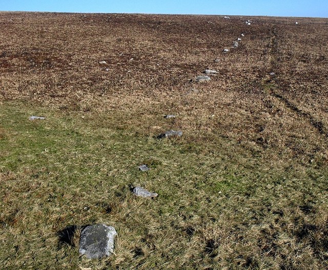
Towards the lower (SW) end the row becomes more fragmentary.

Length of row towards the lower (SW) end. View from north east.

Despite some disturbance the course of the row is still discernible towards the lower (SW) end. View from SW.

The row in the vicinity of the windfarm road. View from south west.

The stones adjacent to the windfarm road. View from south west.

The stones adjacent to the windfarm road. View from south west.

The stones adjacent to the windfarm road. View from west.

The stones adjacent to the windfarm road. View from north east.

The stones adjacent to the windfarm road. View from north.

The stones adjacent to the windfarm road. View from south west.

Turbine blade crossing the row. View from the south west.

Row next to the windfarm road. View from the west.

Along this length the row points directly at Hartland Point in Devon.

The cairn at the top of the row. View from east.

Terminal stone at the south west end.

View from above and south west of the length adjacent to the windfarm road.

View from above and north east of closely spaced stones in the central part of the row.

View from above and south west of closely spaced stones in the central part of the row.

View from above and south west of a section of the lower (SW) part of the row.
 View from above and west of a section of the lower (SW) part of the row.
Access Information
The Bancbryn row is remarkably tricky to get to which might in some part explain its survival. Car parking for a single vehicle is available at SN 69140 11600. From here walk south on the footpath to SN 68702 10957 and then follow the windfarm track to the top of Bancbryn. The top of the row is to the left of the track and the remainder to the right. Vegetation conditions will determine how much of the row is visible. Following swalling the stone is very obvious, but at other times most of it is hidden by vegetation which explains why it has remained undiscovered for so long. Alternatively the row can be reached by parking at SN 65234 10304 and following the windfarm roads or parking in Gwaun-Cae-Gurwen and taking the footpath leading west from SN 70470 11304.
Online Resources
Megalithic Portal Coflein Archwilio Sea Views Cotswold Archaeology
A Stone Alignment at Bancbryn Request for Scheduling Parallels
Comments on Preliminary Statement Response to Cotswold Archaeology Report
Dyfed Archaeological Trust Excavation Report Archaeological Guide to Mynydd y Betws
Timeline
VISITED:- 2nd January 2012 and many times subsequently
FIRST PUBLISHED:- 27th January 2016
LAST UPDATED:- 23rd November 2020
