
Looking south along the rows. Only some of the largest stones are visible (Scale 1m).
A fan-shaped multiple stone row measuring 12.4m long, including at least 42 small and medium-sized stones arranged in at least 4 separate lines and situated on a south facing slope within a forest clearing. The row is orientated north to south and there is a probable cairn at the upper northern end. The row stands in an area containing a standing stone and prehistoric settlements.
Location
| Scotland | Sutherland | Northern Scotland | NC 71620 34865 |
| Lat 58.28369893 Long -4.19114116 | |||
Map showing the location of Loch Rimsdale stone row.

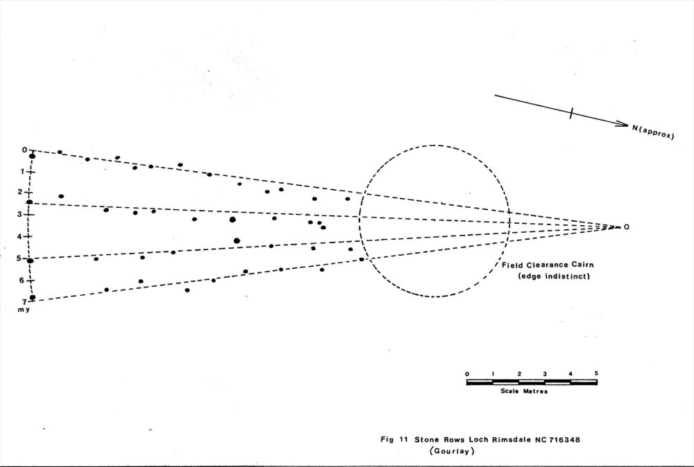
Simplified plan of Loch Rimsdale stone rows. From a survey by Gourlay, R.A. available here.
Characteristics
| Type: Multiple | Length: 12.4m |
| No. of stones: 42 | Size of stones: Small and medium |
| Orientation: 0° | Altitude: 200m |
| Upper end: Cairn | Lower end: – |
| Straight (Yes or No) : No | Sea View: No |
| Context: Standing stone and prehistoric settlement | |
| Notes: 4 rows. Tallest stone stands 0.43m high. The rows are surrounded by forestry and no assement of the visual relationship with the landscape was possible. | |
Other Information
| Public Access: Yes |
| Land Status: |
| Scheduled Ancient Monument: No |
Identification
Category: Plausible. No doubts have been expressed regarding the prehistoric interpretation of this row.
Typology
This stone row is of Type M4. Information on this form of stone row and other rows of this type is available here.
Photographs

Terminal stones at the lower southern end . View from west (Scale 1m).

Terminal stones at the lower southern end . In common with many multiple rows the largest stones are at the bottom. View from east (Scale 1m).

Terminal stones at the lower southern end . View from north west (Scale 1m).
Three small stones forming one of the rows at Loch Rimsdale. View from south (Scale 1m).

The row is mainly composed of very small stones (Scale 1m).

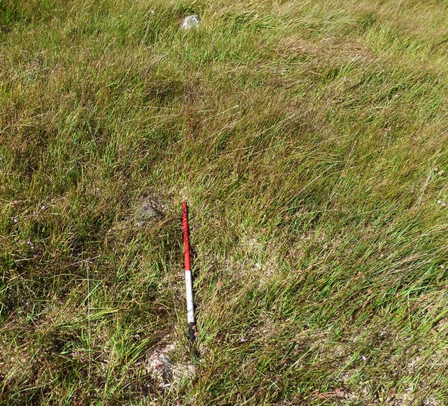
Looking south along the rows. Some of the terminal stones are visible next to the ranging rod (Scale 1m).
Access Information
Car parking is available at NC 72361 39899. From here it is a very long walk to the stone row. Follow the path leading south from the parking area to NC 72471 37400. Then follow the forestry fence to NC 72559 36476. Climb the stile and then follow the forest ride. It may be best to keep to the left hand side. At NC 71904 35164 cross the forest track and follow a second ride to a forest clearing at NC 71715 34933. A standing stone close to this point is not part of the row. From here the row is about 130m to the west. Having visited the row it is a long way back and you need to allow plenty of time. Alternatively if you have access to a bicycle it may be possible to follow forest tracks from a car parking area at NC 69045 42692. Either way this is not an easy row to get to.
Online Resources
Megalithic Portal Canmore Historic Environment Record Caithness Field Club Bulletin
Other References
Burl, A., 1993, From Carnac to Callanish – The prehistoric rows and avenues of Britain, Ireland and Brittany, Yale University Press, New York and London, pg. 224.
Gourlay, R. A., 1975, Field Survey in the Loch Rimsdale Area, Glasgow 1975.
Timeline
VISITED:- 6th September 2016
FIRST PUBLISHED:- 13th February 2016
LAST UPDATED:- 2nd January 2018
