View from north (Scale 1m).
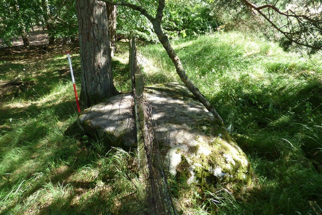
A single stone row measuring 9.5m long, including three large recumbent slabs. The row is orientated NNE to SSW and the southern slab has a pair of cup-marks on its upper surface.
Location
| Scotland | Perth and Kinross | Central Scotland | NO 16820 36049 |
| Lat 56.50920868 Long -3.35322868 | |||
Map showing the location of Gallowhill Wood stone row.
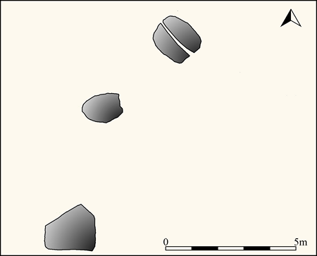
Plan of Gallowhill Wood stone row (Source 1:100 survey by Sandy Gerrard)
Characteristics
| Type: Single | Length: 9.5m |
| No. of stones: 3 | Size of stones: Only large |
| Orientation: 25° | Altitude: 123m |
| Upper end: – | Lower end: – |
| Straight (Yes or No) : No | Sea View: No |
| Context: – | |
| Notes: | |
Other Information
| Public Access: Yes |
| Land Status: |
| Scheduled Ancient Monument: Yes |
Identification
Category: Probable. Although depicted as a stone circle on Ordnance Survey mapping the visual evidence strongly suggest that it is much more likely to represent a stone row. The lack of any other similar sized stones in the vicinity combined with the fact that the slabs can be resolved into a near straight line makes a stone row interpretation much more probable.
Typology
This stone row is of Type S2. Information on this form of stone row and other rows of this type is available here.
Photographs

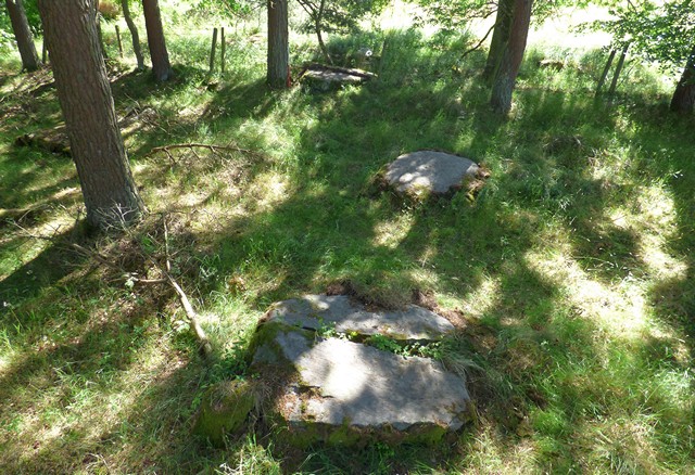
Stone 1 in the foreground has been split. Stone 3 in the background has been incorporated into a later field boundary. The absence of any other large stones in the vicinity combined with the fact that the stones can be resolved into a line means that this is probably a stone row. View from above and north (Scale 1m).

The row includes three large recumbent slabs. View from north (Scale 1m).
Individual Stones

Plan of Gallowhill Wood stone row showing the position of the numbered stones shown below.
Stone 1
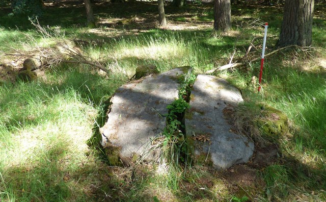
Stone 1 is recumbent and has been split into two parts. The stone as a whole measures 1.61m long, 1.62m wide and stands up 0.6m high above the ground surface. View from south-east (Scale 1m).

View from the south (Scale 1m).
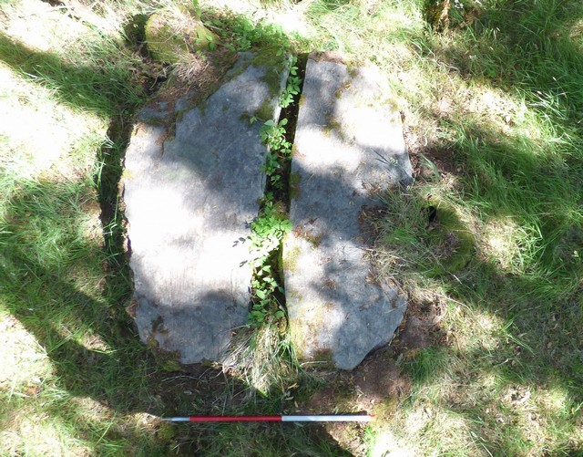
View from above and south east (Scale 1m).
Stone 2

Stone 2 is recumbent and measures 1.62 long by 1.05m wide and stands up to 0.34m high above the ground surface. View from west (Scale 1m).

View from north (Scale 1m).

View from east (Scale 1m).
Stone 3
Stone 3 is recumbent and has been incorporated into a later field boundary bank. The stone measures 2.07m long by 1.53m wide and 0.28m high on the northern side. View from west (Scale 1m).

View from north-west (Scale 1m).
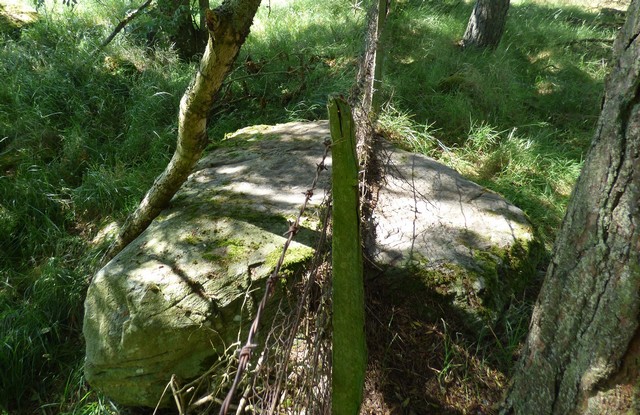
View from east. There are two cup-marks on the upper surface of this slab. One is visible to the right of the fence post.

View from the south east (Scale 1m). The southern part of the stone is exposed within the ditch associated with the field boundary. This relationship implies that the stone had been “felled” into a pit or that there had been a considerable accumulation of soil in the time since it toppled.
Access Information
Limited car parking is available nearby at NO 16695 35933. Please ensure that you get permission from the owners of the adjacent house before leaving your car.
Acknowledgements
Help with the fieldwork and in particular a search of the surrounding area was carried out by George Currie whose help is gratefully acknowledged.
Online Resources
Megalithic Portal Modern Antiquarian Canmore
Other References
Ruggles, C.L.N., 1999, Astronomy in prehistoric Britain and Ireland, Yale University Press, New Haven and London, 197.
Timeline
VISITED:- 6th July 2018
FIRST PUBLISHED:- 12th February 2016
LAST UPDATED:- 15th March 2019
